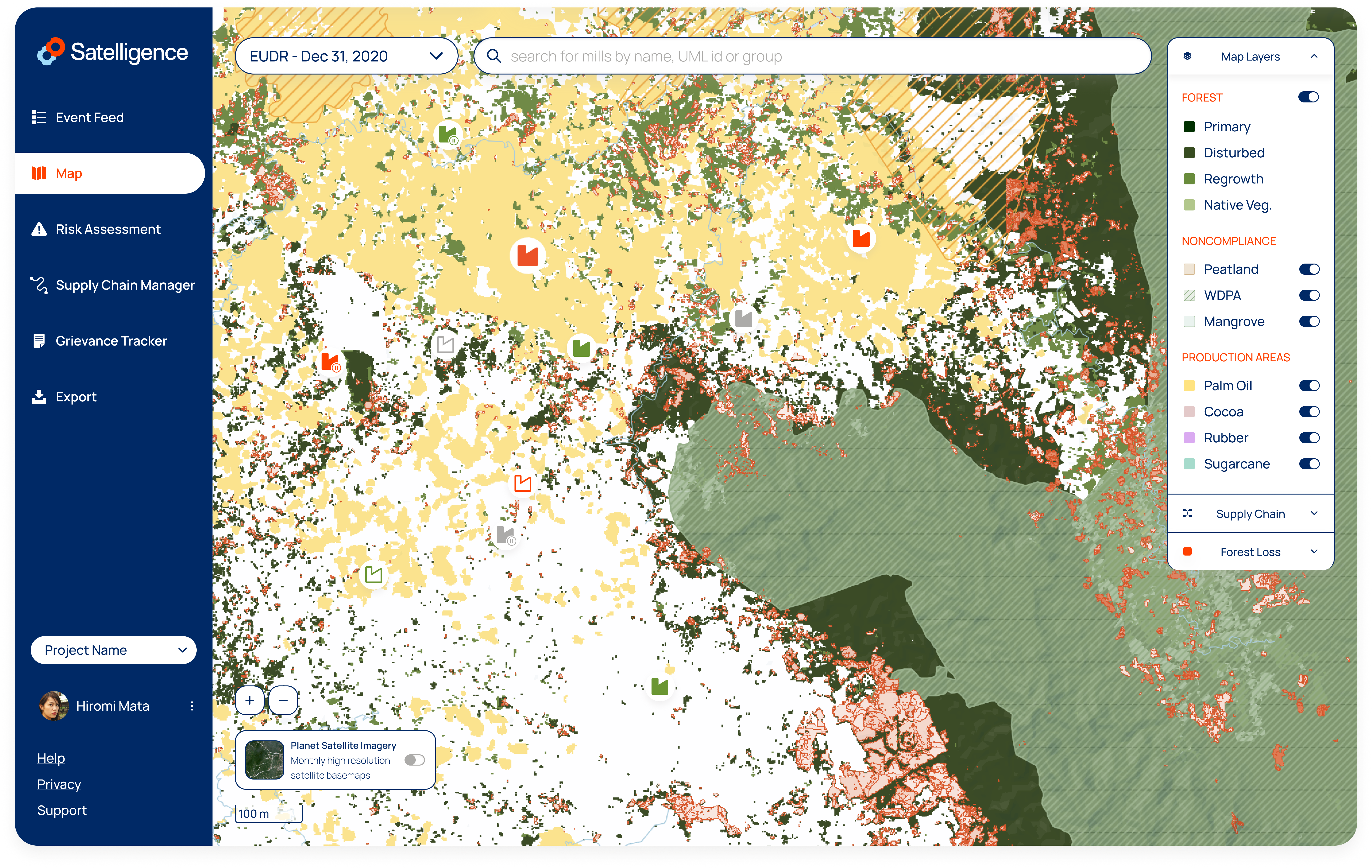
An always up to date, interactive map of the world displaying deforestation, forest, noncompliance boundaries, production areas and spatial supply chain entities.
Navigating the map
The top right of the map shows the map legend and layers. The pane allows you to switch map layers on and off for customization of the map.
The information displayed on the map is hierarchically organized as follows:
Map layers
- Forest
- Contextual noncompliance areas
- Production areas
Supply chain
- Plots/concessions/mills, depending on your organization's supply chain
Forest loss
- Detections
Map Layers
This section includes our land cover information, such as our remaining forest layer and commodity layers, that can be toggled on/off for more visibility using the map layers button on the map.
Forest Types
Though every tree counts, not all forests are equal when it comes to tackling deforestation in supply chains. In some instances, detections may only involve changes in forests that were degraded earlier or fires inside commodity production areas.
Identifying the type of forest that has been affected by deforestation, allows you to prioritise non-compliance in your supply chain and focus on the sourcing areas that are most at risk.
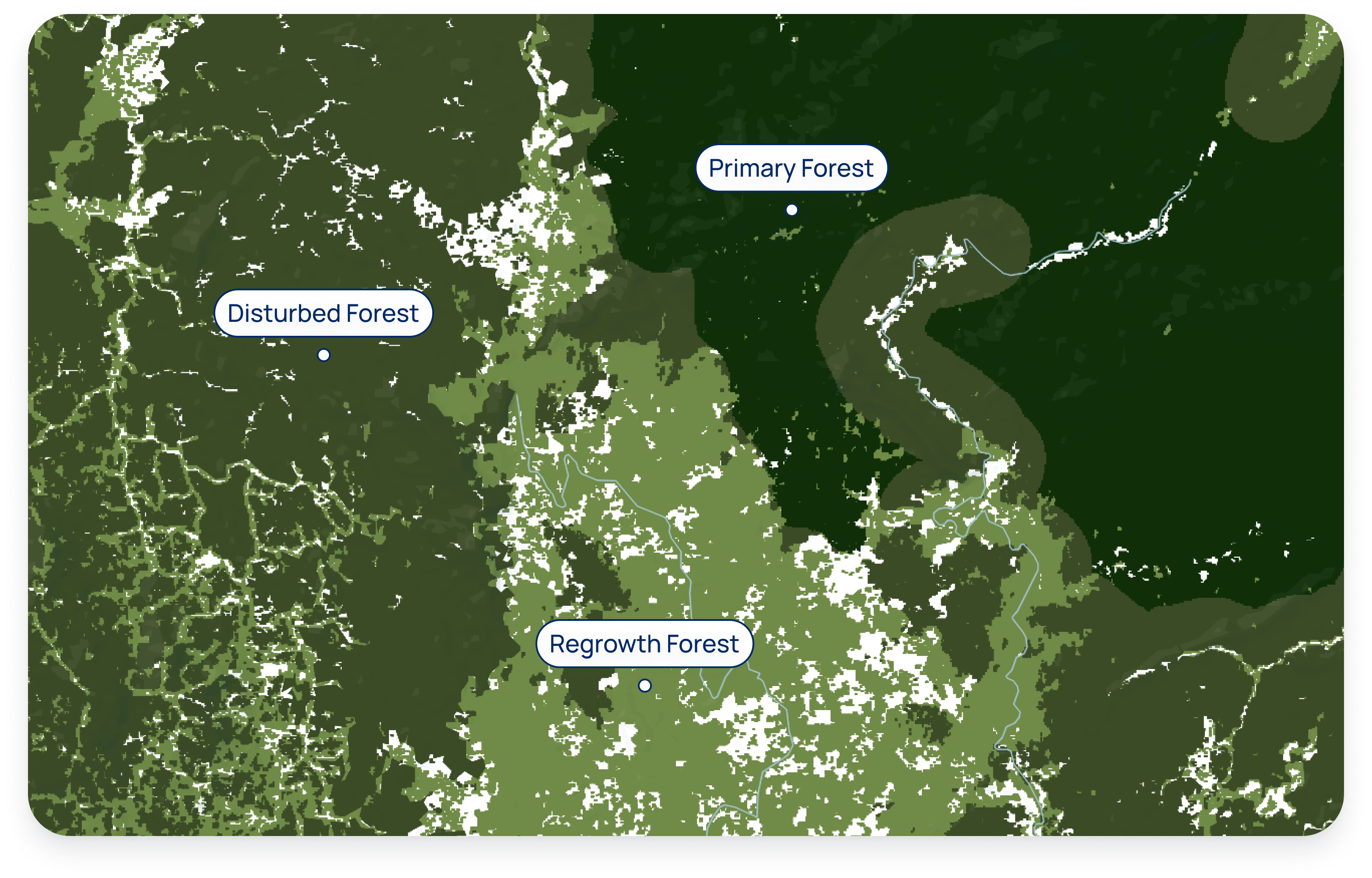
Primary forest: Large intact, unfragmented forest areas with insignificant human activity such as logging, forest management, or conversion; including native biodiversity and unbroken expanse of natural ecosystems. This includes High Conservation Value (HCV I Species Diversity) and High Carbon Stock (HCS) High Density Forest.
Disturbed forest: Intact forest affected by some human activity but with limited or older disturbance, such as logging or forest management. This includes HCV II (landscape-level ecosystems, ecosystem mosaics and IFL) and HCS medium- and low density forest. This layer typically includes many logging concessions that have been actively logged in the recent past, and therefore cannot be classified as primary forest.
Regrowth forest: All remaining forest that cannot be classified as either primary or disturbed, including secondary forest through reforestation, or afforestation after other dominant land use. A secondary forest is a forest that has been logged or heavily degraded and has recovered naturally or artificially. This layer typically has a lower conservation value, and includes HCS Young Regenerating Forest.
Non compliance
The non compliance section contains land cover layers that have a special status in addition to regular forest classes. Examples include peat, mangrove, protected areas and indigenous territories.
Production areas
Depending on your organization settings you will have specific commodity maps available. The layers can be toggled on and off.
Supply Chain
An interactive legend expands when clicking on the supply chain button. If you are monitoring cocoa you will find plots on the map. If you are monitoring oil palm supply chains, you will find plots, concessions and mills. Concessions are either independent (a vertical hash) or associated with a mill (a diagonal hash). A mill association is determined when a mill sits inside a concession or when the concession has a group level affiliation with the mill within a 100km of the mill.
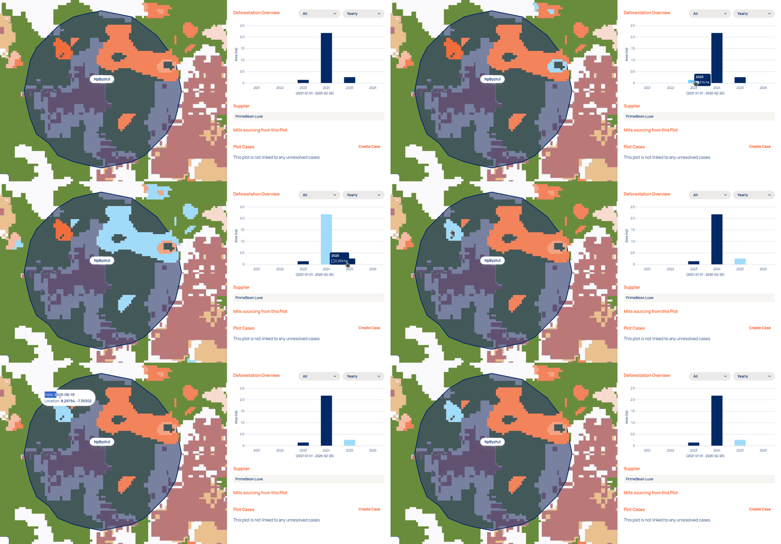
Upon selection of supply chain entities a side panel will show available information on the supply chain entity and a deforestation timeline. Selecting a bar in the chart will allow you to highlight the deforestation from a selected period on the map.
When an aggregator is selected, the map will pan to all related plots that are supplying the aggregator.
Forest loss
The forest loss section contains all map layers related to the loss of forest. Currently there are two map layers available for toggling on and off:
- Deforestation detections
- Jurisdictions
Detections
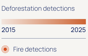
Detections show the loss of forest over time on the map. The shade of red indicates the recency of the deforestation with darker red colors resembling more recent deforestation. The Satelligence deforestation detection system contains more information on how detections are created.
Hovering over deforestation in the map anywhere will prompt a little popup that tells you the exact date of deforestation and its location. 📍
Jurisdictions
To access the layer, on the right side menu, click on the 'Forest Loss' arrow to open it. You will see 'Detections' and 'Jurisdictions'. Here you can toggle the jurisdictional layer on. As the view on the Map can become quite crowded with all layers visible, it may help you to turn the 'Concessions' and/or 'Plots' off in the 'Supply Chain' menu on the right.
As the view on the Map can become quite crowded with all layers visible, it may help you to turn the 'Concessions' and/or 'Plots' off in the 'Supply Chain' menu on the right.
Satellite Basemap Switcher
Enjoy switching between Planet’s monthly basemaps to view generic nuances of land cover types and analyse historic deforestation. A toggle is available to turn on/off the Planet Satellite Layers. When the satellite layer is on, the forest loss can be also toggled on/off.
Search Bar
If you would like to verify a grievance that has been raised by a third-party for a specific location, you can type in the coordinates in the search bar as latitude, longitude. Example: 2.587, 98.548 takes you to Sumatra Indonesia for further fact checking. You can also use the search bar to navigate to cities and points of interest or browse the map using your mouse or keyboard, it is fully interactive.
Plot layer updates
When users upload new plots to your supply chain, the map will be updated. Updating plots on the map can take a couple of hours depending on the amount of new plots. While the change is in progress, the existing plots will remain visible on the map. A loading indicator will notify you about the fact that an upate to your map layer is in progress.