Managing suppliers
The Supply Chain Manager allows you to add suppliers and start uploading plots for them.
If you already have a Satelligence account then your supplier column will be pre-populated. Without any suppliers in the platform you are given two options:
-
Start with adding your first supplier.
-
Contact support for when you already compiled a dataset of your supply chain data. This dataset can be a mill list or a file with all the plots of all your suppliers. Especially when your dataset covers many suppliers our support team can save you some time.
-
A maximum of 1000 suppliers is supported
![]()
When you go for the option to add your first supplier, you will be prompted to give the supplier a name. Type the name and press enter or click on Submit to proceed or the blue cross to cancel. You can always remove a supplier after creating it.
In almost all cases it best to add all your tier one suppliers using the name you also use internally but it is a free text field and you are free to use the supplier field for indirect suppliers. We use the suppliers to group plots and to provide overview stats on the overall risks and compliance.
Geolocation data requirements
File type
Polygons need to be provided in valid geojson format with .json or .geojson extension and represent a FeatureCollection of Points, Polygons or MultiPolygons.
Point data can also be provided as .csv or .xlsx file. Only the first tab of the xlsx file is parsed for point data. The geocoordinates have to be provided as lat or latitude and lng or longitude.
File requirements
-
Invalid geometries are accepted, proper functioning of the upload function and risk assessment are guaranteed up to 25 self intersections per polygon.
-
The coordinate reference system of the file needs to be WGS84
-
Duplicate geometries per supplier are not allowed
-
The maximum number of features per file is 400.000
-
The maximum number of files per upload is 100
-
The maximum file size is 1 GB
-
The maximum size of combined files for an upload is 2 GB
Plot requirements
Polygons:
-
Area must be between 0.0001 ha (one square meter) and 100.000 ha
-
Maximum 1000 vertices per polygon are supported
Points:
-
A default of 4 ha area is used if the area is not provided as property
Plot properties
A number of optional properties are supported and can be added to plots. The information allows for easier integration with the Traces information system and allows you to search for your plots with internally used IDs or names. All other properties are preserved in the exports with no interference from the platform.
|
Attribute |
Description |
Supported uploaded field names |
Example |
|
ProducerName |
the producer name for the corresponding plot, typically this is a farmer id or cooperative or other type of first level aggregator. One ProducerName can link to multiple plots |
|
Producer_01 |
|
ProducerCountry |
The country of production enforcing the ISO2 country codes |
|
ID |
|
ProductionPlace |
A name or ID for the plot provided by the user |
|
S11_123456 |
|
Area |
plot size in ha used to explode points in circular polygons of the equivalent size. When omitted the point is rendered and assessed as a 4ha plot. |
|
2.17
|
|
|
|
|
|
|
Additional palm oil specific properties |
|||
|
UmlIds |
A comma separated string of UmlIds to link plots to mills in your supply chain |
|
PO1000004383, PO1000004384, PO1000004385 |
Read Data Collection and Data Cleaning for more guidance on how to prepare your data for upload.
File upload
Selecting files
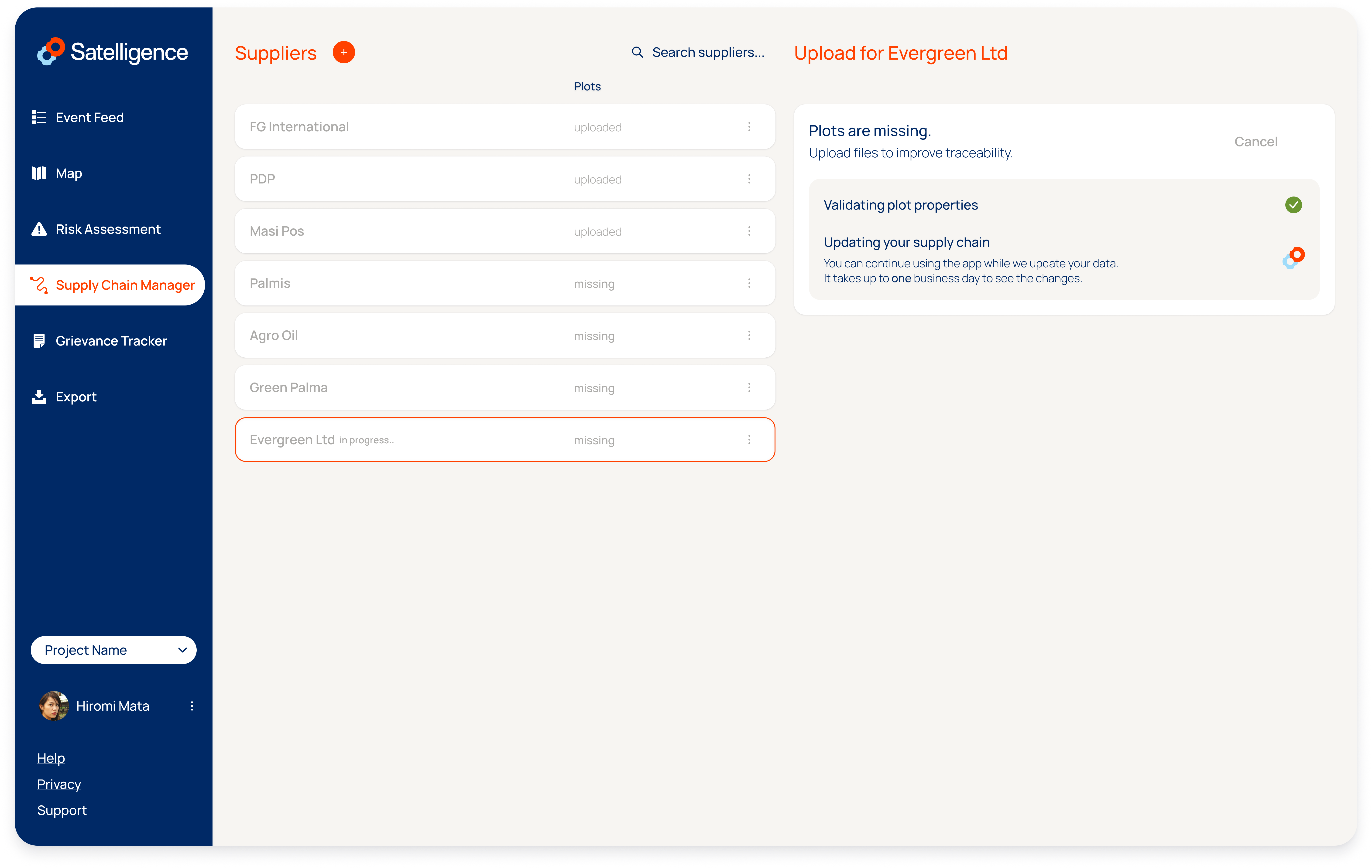
Select files from your file browser and drag those into the drop zone or click Browse to open a file picker. You can add multiple files (with the extension .json or .geojson) and the files can contain a mix of different geometry types. When you have all the files lined up, proceed by clicking Add Plots. You will first see a message Validating plot properties, followed by Updating your supply chain. You can leave this page and await updates to the platform. It takes up to one business day to see the changes.
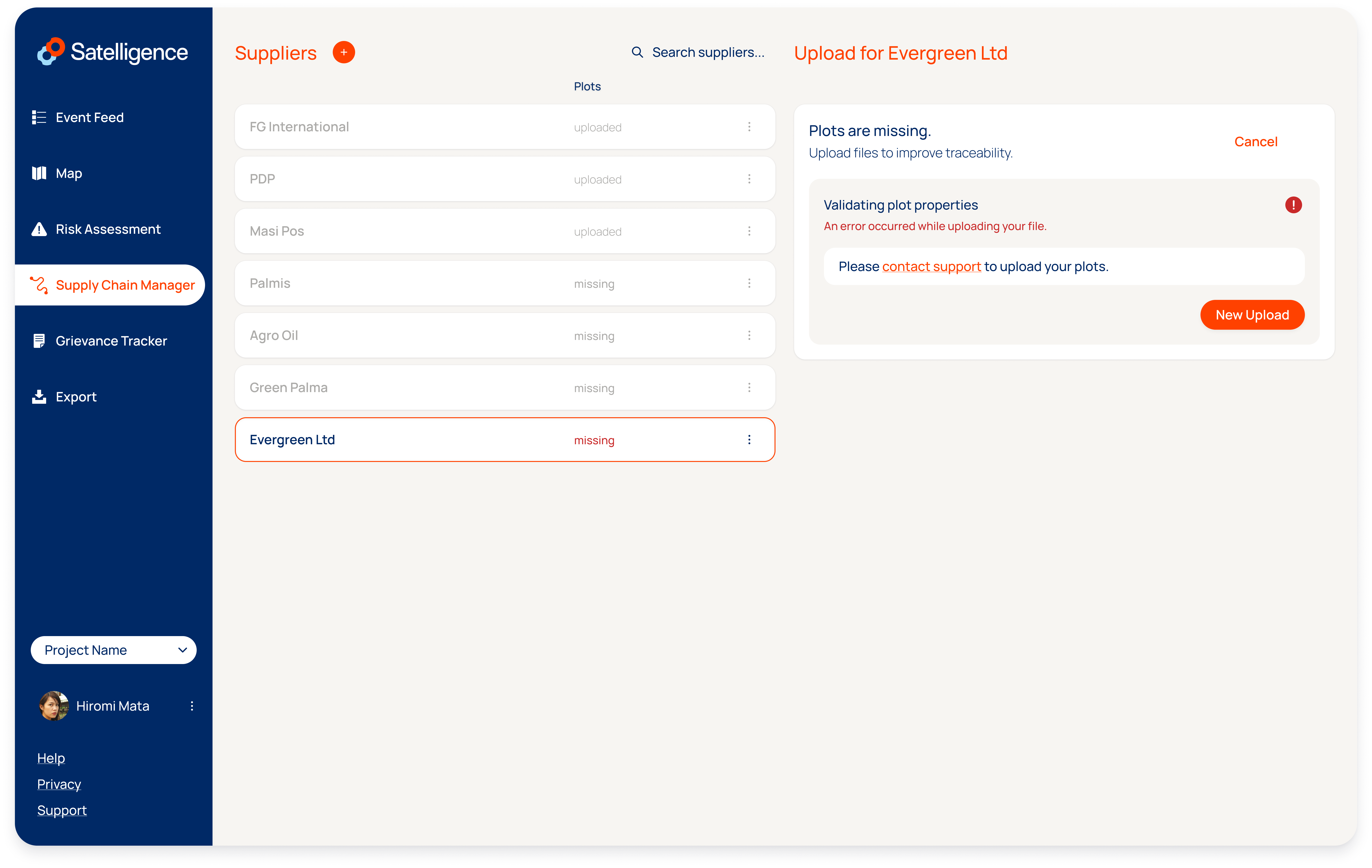
Upload errors
More information on errors and solutions can be found here: Error handling
If you run into any errors, an error file is available for download in the user interface. The file contains specific information on the error that occurred on a per feature basis. Use this file to fix your errors before trying to submit the file again.
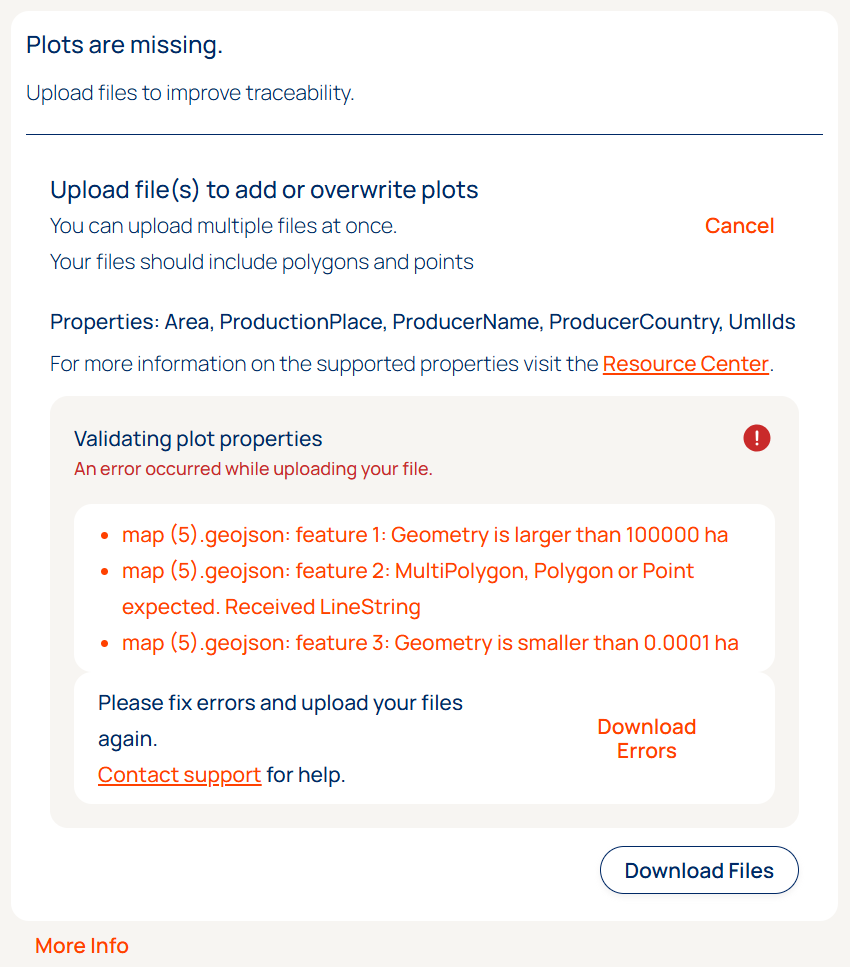
When dealing with errors, it is possible to validate your file using an online geojson validator. We like geojson.io but there is also an official validator from the European Commision. If that is not helping contact support@satelligence.com preferably including the plots you are trying to upload.
You can choose to upload the non-erroneous plots. To keep track of what you are ingesting and what plots are ignored, make sure to download the Error File before clicking Proceed with Errors.
Examples of when it makes sense to proceed with errors:
-
You adding a set of plots that contain plots that have been added to the supplier in an earlier upload. You will see the error message
A supplier cannot have multiple plots with the same geometry, click proceed with errors to add the plots that were not in the earlier set. You will not see duplicate plots for the same supplier in the system. -
You see the error
Geometry is smaller than 0.0001 hafor some plots in your file. This may happen when the producer of the file mistakingly cut plots into small pieces. In this case, proceeding with errors likely enables you to assess the majority of plots and almost the entire area of the combined plots. We advice to download the error file before proceeding and contacting the sender of the file to confirm that these plots can be ignored.
Successful Upload
If the plot upload went well you will see the supplier on the Risk Assessment page. Navigate to the Risk Assessment page using the left menu and click on the supplier you just created. You will see one or more plots corresponding to the plots you just uploaded.
Automatic update flow
-
The supplier will be added to the Risk Assessment page immediately when created in the Supply Chain Manager
-
The number of plots in the uploaded file will be listed immediately when clicking on the supplier on the Risk Assessment page
-
The number of assessed plots will be listed in the top left above the plots when clicking on the plots. This number will be 0 at first, but it will match the number of plots in the uploaded file within 24 hours. Once assessed the plots will be categorized into the Deforestation Free categories and assigned the Negligible risk categorization and Risk Factors
-
The map usually takes longer than the Risk Assessment and will show up within 24 hours.
-
The event feed will lists events as inside plot when overlapping with the plot within 24 hours
Add more plots
If you have more plots for the same supplier you can add these to the plots already in the system.
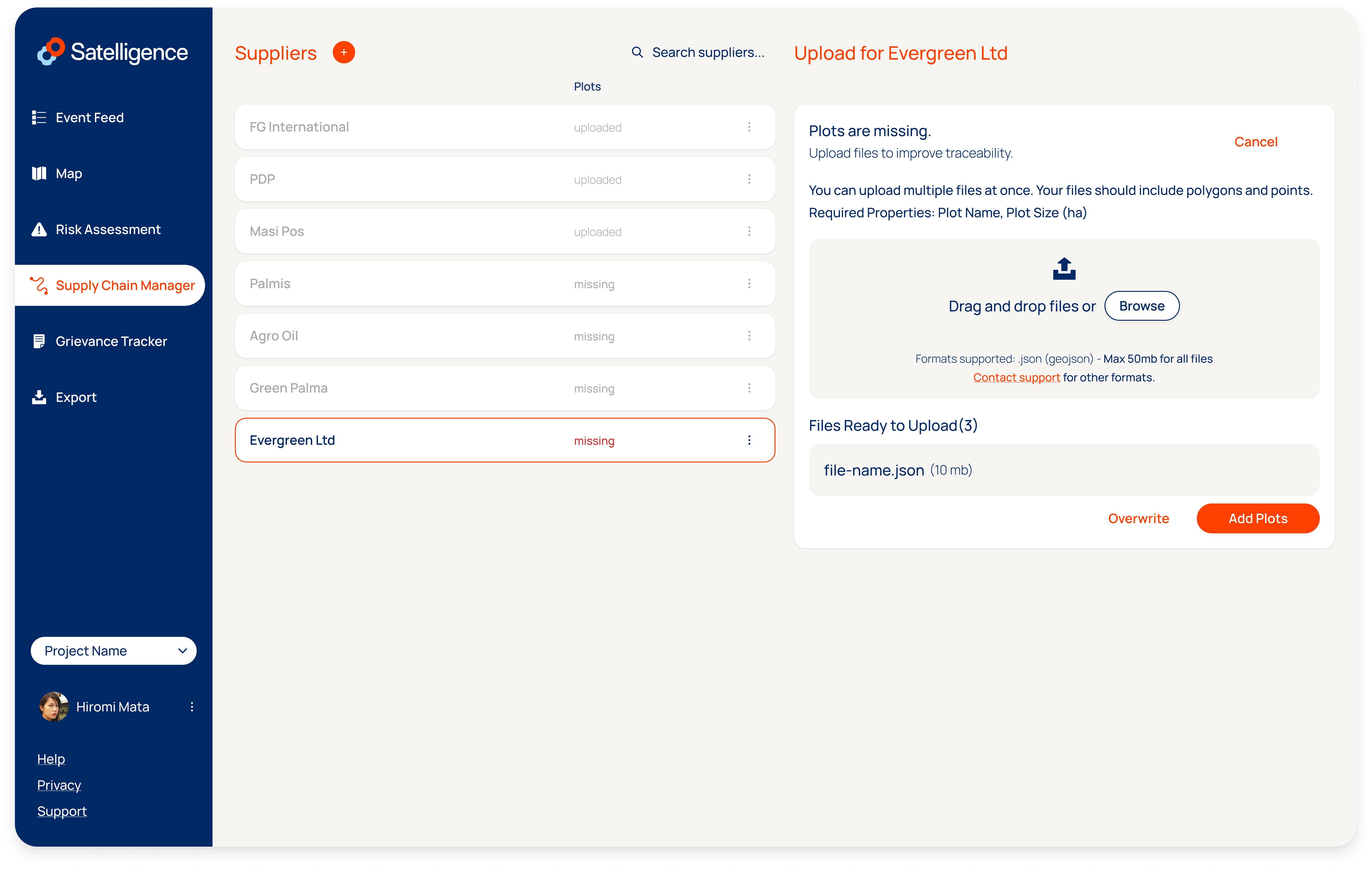
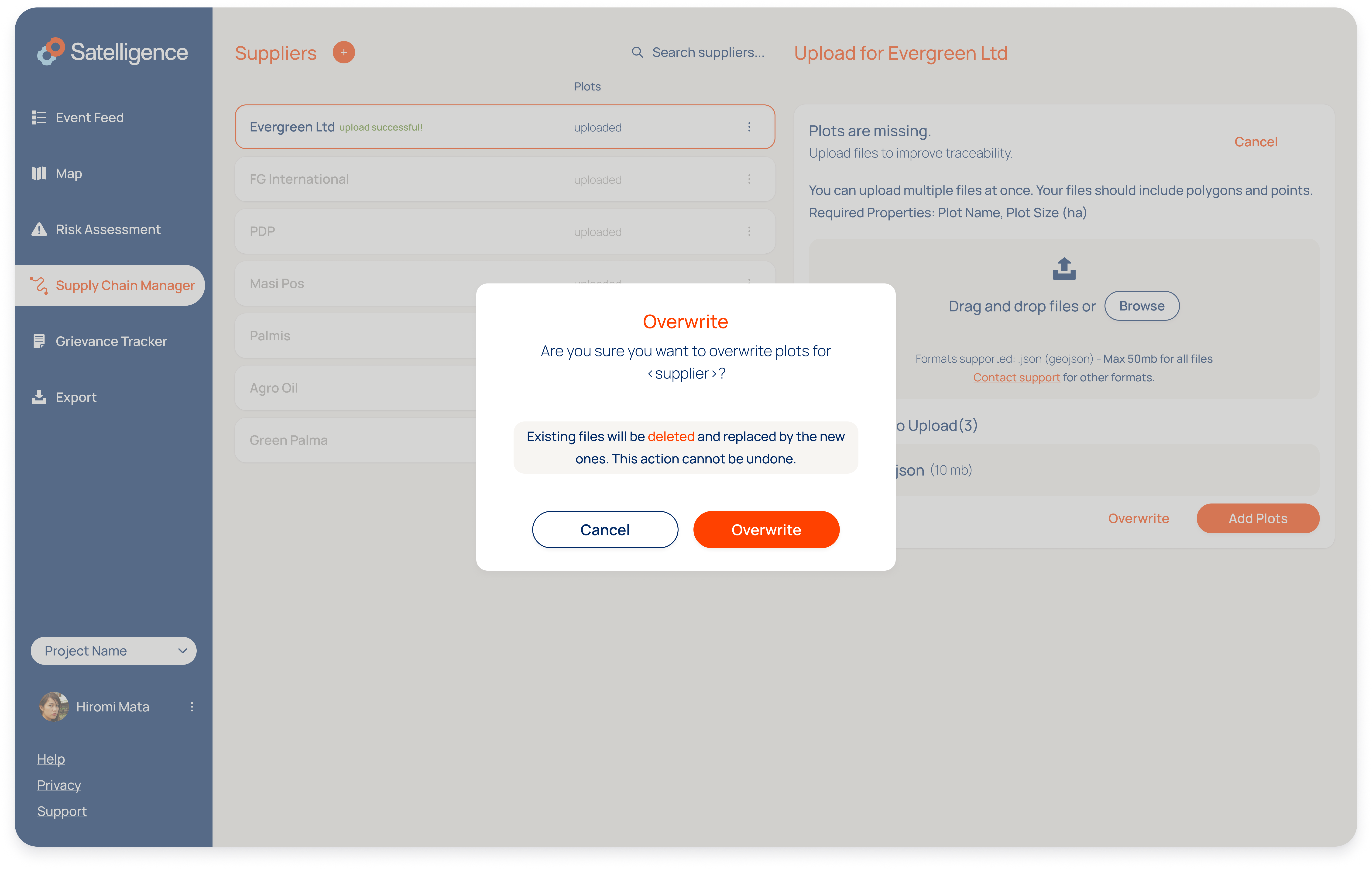
Replace plots
If you want to replace the plots, go through the same steps of adding the plot files, but click Overwrite instead.
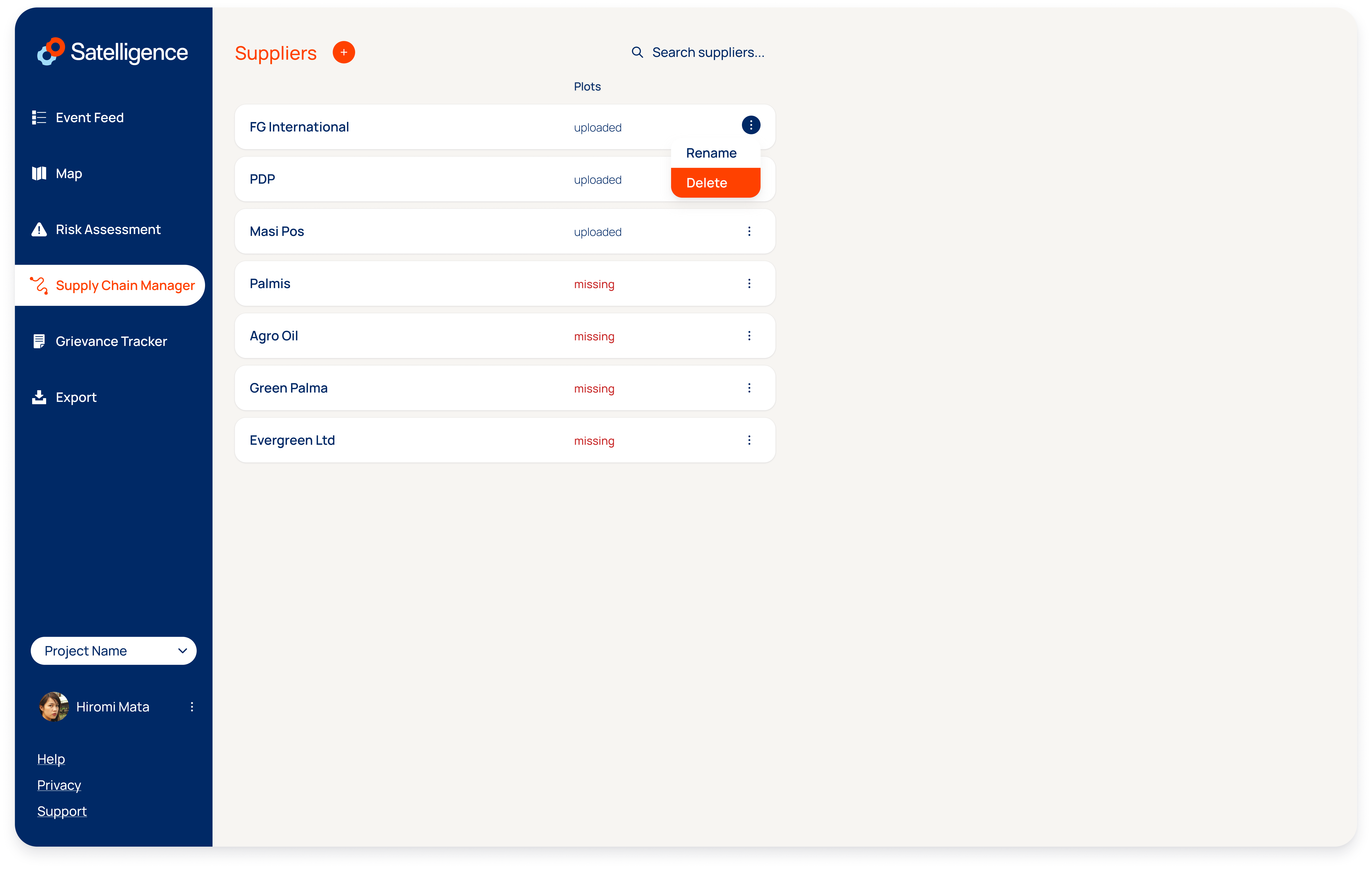
Delete plots
To start from scratch, click on the three vertical dots to the right of the supplier line and click remove to delete the supplier and all its associated data. Recreate the supplier to start with a clean slate.
Supplier forms
To request geolocation data directly from your suppliers you can use the so called supplier forms in the supply chain manager tab.
sharing geolocation data requests with your suppliers
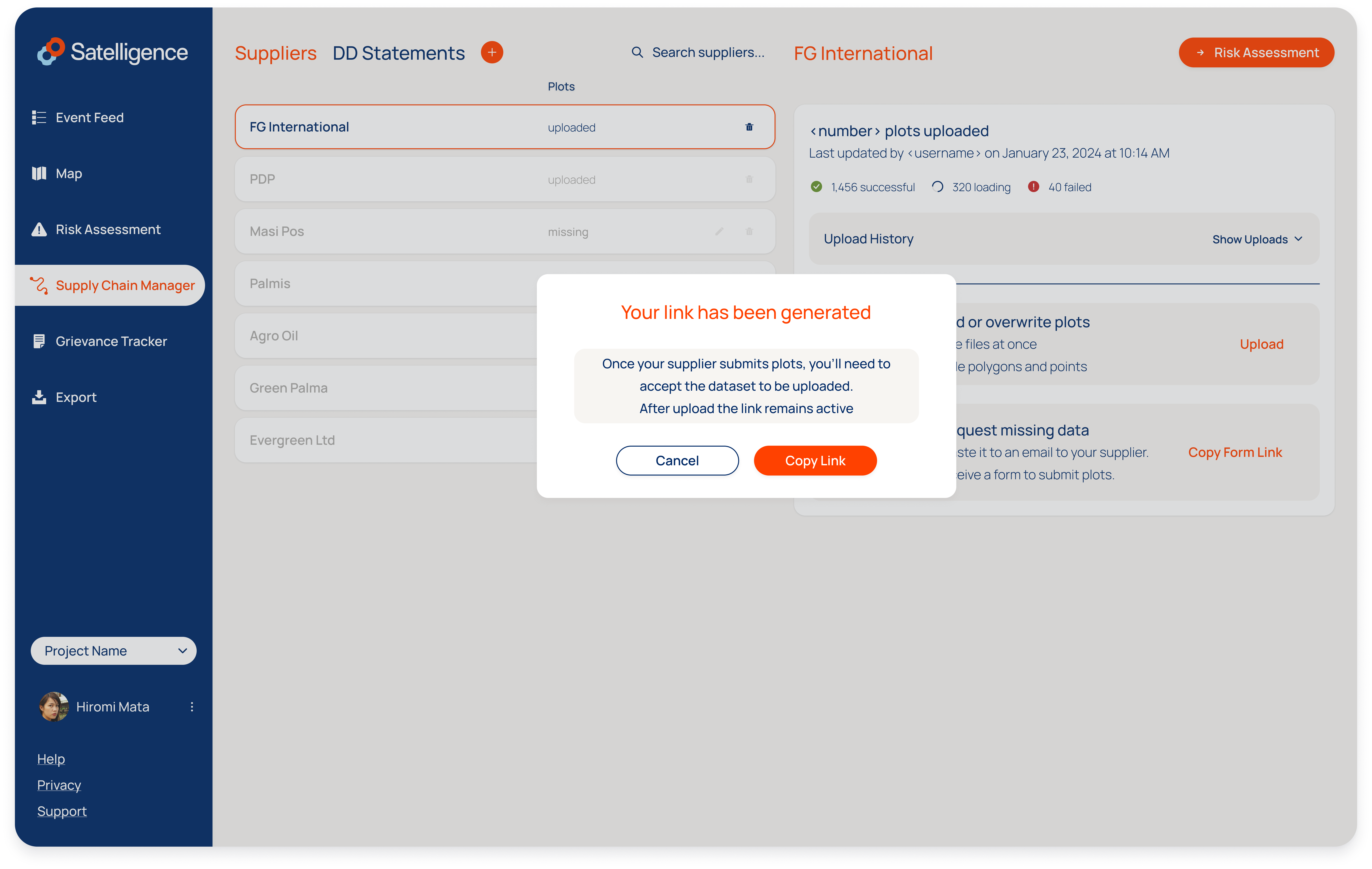
A secret link can be generated per supplier that can be copied and shared directly with suppliers via any preferred communication channel.
After the request is shared, suppliers can follow the link to arrive at a page with the standard plot upload interface used in the platform. When suppliers have questions about the file upload, the documentation on the satelligence resource center can be shared with them.
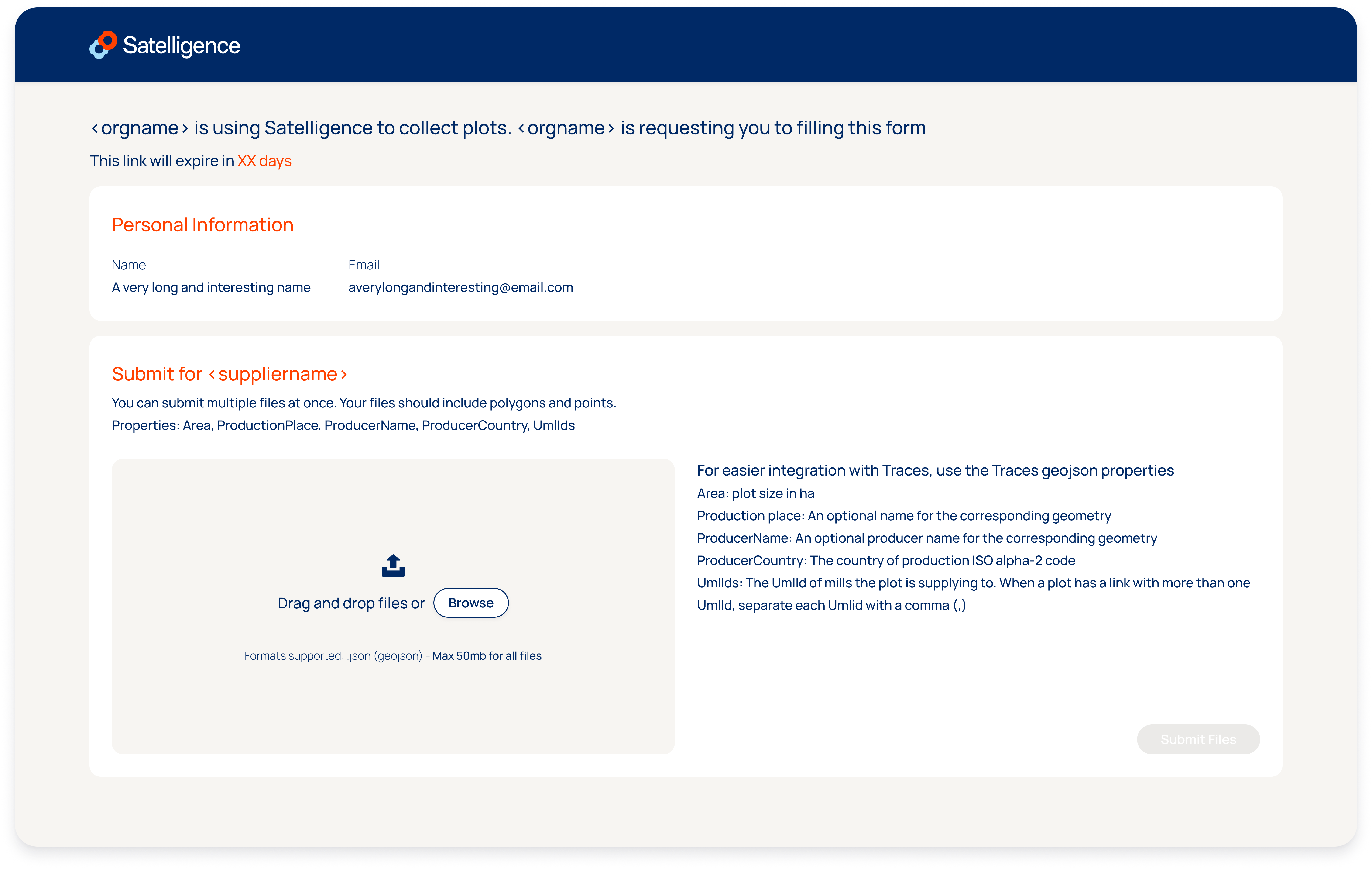
Reviewing and accepting uploaded plots
After plots have been uploaded by a supplier the file has passed the quality checks that are embedded in the platform. The file will be available for download to allow a review of the data. To finish the process the plots need to be accepted to overwrite or be added to the existing supply chain dataset.
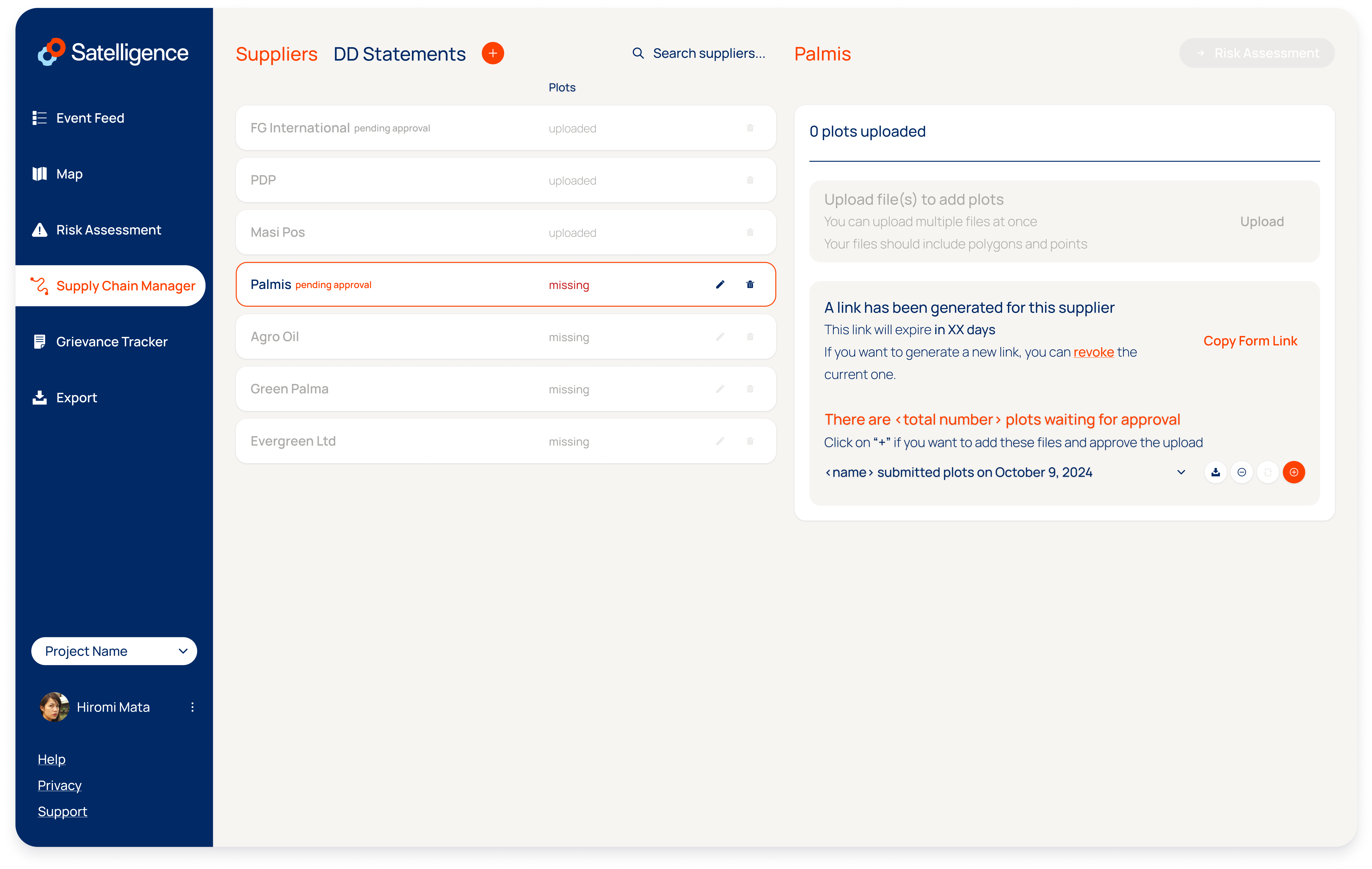
Revoking a link
After data submission the link to the supplier form can be revoked. Revoking link after data sharing is completed is generally considered a best practice to prevent any unwanted uploads.